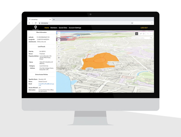
Following successful BETA testing last year we’ve been busy building a brand new, more powerful version of our software – and we’re delighted to announce that it’s here 🙌
Our new platform contains over 56 million land parcels, mapped out against multiple other data sets; Flight Restriction Zones, Crown Estate Foreshore, National Trust Land, SSSI’s – check out our resources page for why these are important.
Drone Pilots
Search for any Landowner, seek permission and find places to fly your drone responsibly.
Registration is Free, including access to Drone Policies with the option to upgrade for land parcel info.

Landowners
Communicate your Drone Access Policy to the drone community and access a network of responsible flyers.
We’ve started loading on Drone Access Policies for our Landowner clients which you can find on the Free map. This includes large landowners who are receptive to airspace leasing for Drone R&D sites. Contact us for more information.
DronePrep: Preparing the world for a future with drones.
