Preparing the world for
a future with drones

View from Above: Chris Gorman takes on the RHS gardens

DronePrep pilot in residence Chris Gorman (aka The Big Ladder Photographer) has been as busy as a bee in the gardens of the Royal Horticultural Society (RHS). Since 2018, he has been capturing stunning aerial images of their sites across the UK. Read on for some words from Chris about his experience flying at all five sites, in all four seasons.
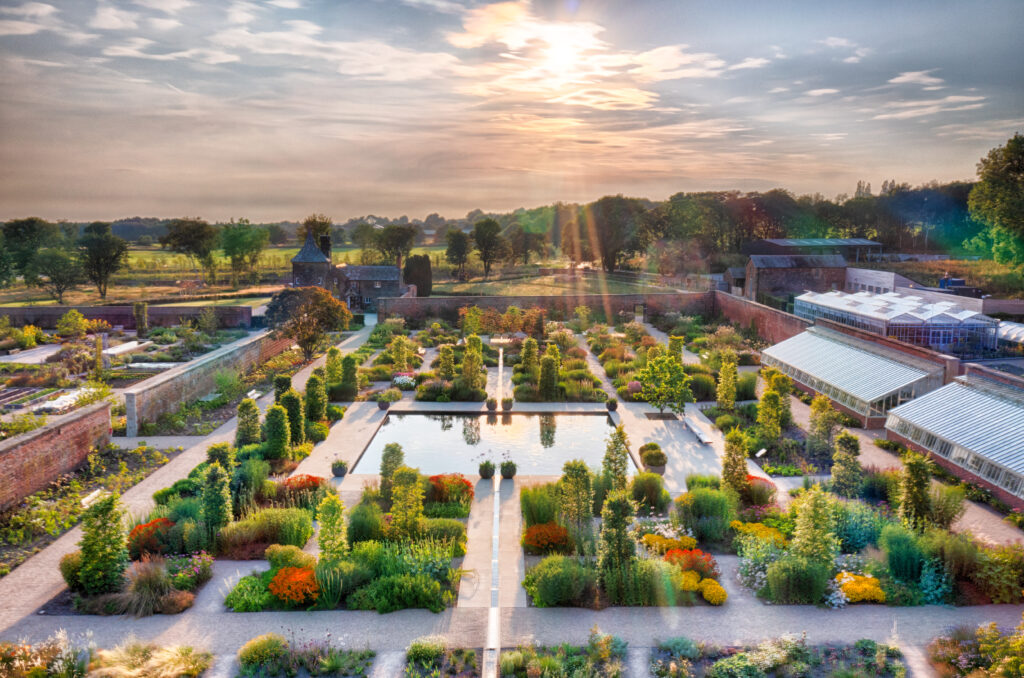
RHS Garden Bridgewater, summer. All images strictly Copyright: Chris Gorman/RHS

Working with the RHS

My relationship with the Royal Horticultural Society (RHS) began in 2018. I was asked by the London Evening Standard to find a drone image showing the beautiful colours of the autumn leaves in London. My first thought was to call the RHS and ask if I could come and photograph the stunning colours at Wisley Garden at sunset. They immediately agreed and the resulting image appeared in the paper the next day.

I was invited back to Wisley by the press team to photograph the garden in more detail, an opportunity I relished. A drone allows you to view the garden from a perspective that previously only the garden designer understood.

After several visits to Wisley, I was then asked whether I would like to photograph all RHS Gardens. That meant all four seasons, RHS gardens across the UK: Wisley in Surrey, Rosemoor in Devon, Harlow Carr in North Yorkshire, Hyde Hall in Essex and, more recently, the brand new RHS Bridgewater in Manchester.

RHS Garden Hyde Hall, winter All images strictly Copyright: Chris Gorman/RHS

Planning photoshoots 

The freedom of creativity that the RHS permits when carrying out this work is why the images work so well. I arrange all shoots based on the weather; sunlight is vital for a good shot. With some of the locations involving 400-mile round trips, I need to be confident that the weather is going to play ball when I get there. This summer has tested this to the extreme, with forecasts often changing drastically from one day to the next. I’ve had a few occasions when three different weather apps have been incorrect!

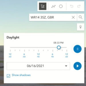
I use DronePrep’s Daylight Tool when planning many of these shoots, it gives me specific information about where the sun is going to be at sunrise and sunset – it’s a feature I absolutely love.

Permission-wise, the shoots are quite easy as landowner permission is already in place with the RHS. The only garden that has airspace issues is Bridgewater in Manchester, due to its proximity to the airport. Manchester Airport has been very helpful so far with permission easily obtained.
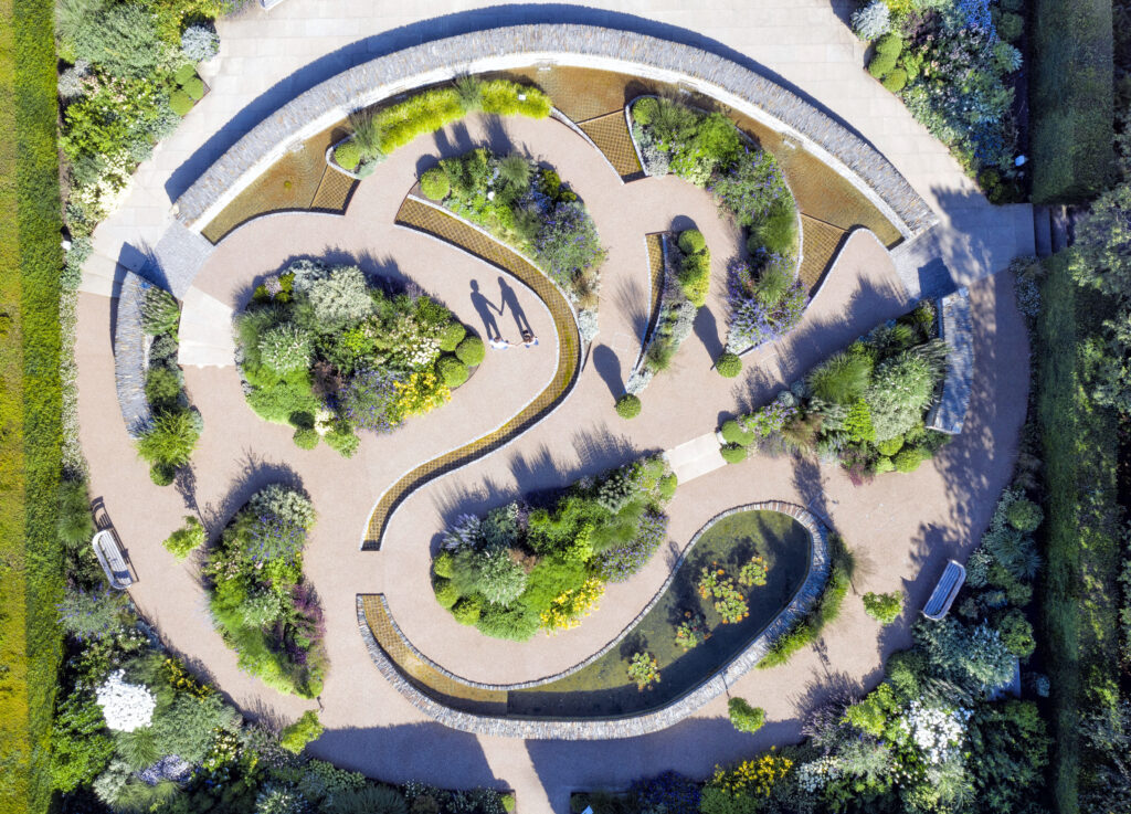
RHS Garden Rosemoor, summer. All images strictly Copyright: Chris Gorman/RHS

The resulting images

Many of the images have appeared in the national press, From the Daily Telegraph and The Times to the Daily Mail and Daily Express. As a media photographer with nearly 30 years of experience, I know exactly what a picture editor likes to see. Crucially, an image needs to be pitched to a newspaper at the right time. Even a great picture needs a news hook to hang it on… hot weather, national gardening week, and so on.

The RHS has allowed me to indulge my passion for shadow images. There are some great shots of gardeners watering the flowers and raking leaves, or couples walking hand in hand through the roses.

I love how each garden looks completely different through the seasons, with something new to see from the air on each visit. After around 15 shoots at Wisley over the last three years, I still find something new to capture each time.
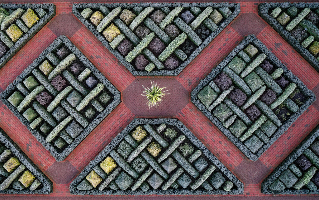
RHS Garden Wisley, winter. All images strictly Copyright: Chris Gorman/RHS

Chris’s images of RHS Hilltop can be seen in an exhibition at Wisley Garden in Surrey. The exhibition will run until mid-September.

Images copyright RHS and The Big Ladder Photographer – check out Chris’s work on Facebook and Instagram.

The DronePrep Map

Chris uses The DronePrep Map to help him plan flights and get landowner permission to take-off. Check out The DronePrep Map for everything you need to plan flights safely.
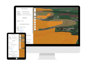
DronePrep Map

View from Above: Chris Gorman takes on Plymouth

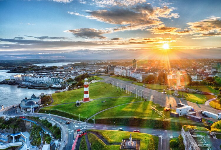
DronePrep’s Pilot in Residence Chris Gorman, aka The Big Ladder Photographer, uses the DronePrep Map for planning aerial photoshoots. Chris just finished an assignment in Devon for the National Lottery Heritage Fund, resulting in this remarkable image of the sunset in Plymouth.

A new dawn for Plymouth. The brief from the Lottery Heritage Fund was simple:

“We’d like a beautiful sunrise or sunset image of Plymouth to send out to media to illustrate our announcement that the city is to be given a £10m grant to help create the UK’s first National Marine Park”.

A simple brief you may think. However, I had just one day to shoot, meaning weather forecasts and permissions needed to fall in line within 36 hours. Sunrises and sunsets aren’t a given, and considering how awful the summer weather has been so far this year, I knew I may struggle.

My first port of call (no pun intended) was the Port Authority and the local council for permission to fly in the Plymouth Sound area. This was the simple part if I’m honest, as the council were most helpful in granting permission straight away after providing all the relevant documentation.

The hard part was the weather.

I arrived in Plymouth to completely grey skies, despite all three of my weather apps forecasting sunshine. The final image you see here was the only time I saw the sun in 36 hours in the town. The shoot was supposed to take place the following day, but I had this sneaking feeling the sun might put in a brief appearance at sunset.

The time of sunset collided with the England-Denmark match, which partially helped as the Sound was near-deserted due to everyone watching the game. All through the very tense first half of the football, I dashed back and forth to the window to check out what the sun was doing. At halftime, I checked once more and, to my amazement, the sun was out in a blaze of glory for the first time that day. I gathered by gear and ran to my pre-arranged take off spot.

I know from experience that a good sunset can last just seconds, which is why DronePrep’s Daylight Tool is so useful when planning these shots. The last hurdle to jump came from the drone itself, which refused to calibrate the gimbal on first start up… This always involves a drone restart, which takes 40 seconds to complete each time. I could see the picture drifting away in front of me…
Suddenly, on the 3rd start up, the drone finally played ball. I launched and immediately took this shot (which is actually a 5-frame HDR blended in Photoshop). This image saved the entire assignment, as the sun didn’t show its face again. And I didn’t miss a single goal in the football!

The resulting image appeared on BBC News, The Daily Express, The Daily Star and various local media.

Check out more of Chris’s work at www.bigladder.co.uk

View from Above: The Daylight tool and why lighting matters

The DronePrep team are excited to share that we have just released a host of cool new features on the DronePrep platform, including the important buildings dataset and a railway buffer zone. But perhaps the most exciting tool, particularly for photographers or those just looking to snap a few shots while out flying, is the Daylight tool.

The Daylight tool displays not only sunrise and sunset, but also where daylight and shadows fall at different times of the day, throughout the calendar year.

How do I use it?

Make sure the map is in 3D view (button on the left), then click on the light bulb icon under the search bar on the right-hand side of the map display. Choose the date and time, then simply move the slider to see how sunlight affects the map, or hit the play button to watch a time lapse. You can also tick the “show shadows” box to display those all-important shadows – stay tuned for our next update, when we’ll be adding 3D-buildings (and their shadows).

What’s the big deal?

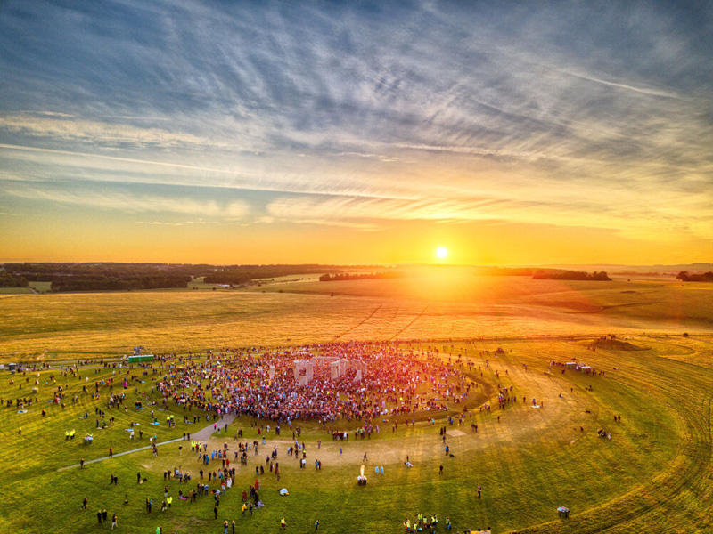
We love the Daylight tool, and if you still haven’t tried it, you might be wondering why. To demonstrate the significance of mapping natural light, we asked our pilot in residence and aerial photographer Chris Gorman how he prepares for a photoshoot. Chris took this shot of Stonehenge during the summer solstice in 2018 (due to lockdown restrictions, access to the stones is prohibited this year).

“This image was summer solstice 2018, the only solstice in recent years to actually see a perfect sunrise. As a photojournalist and picture editor, I’ve seen a mountain of pictures of the solstice over the years, which are all pretty much the same. Usually silhouettes of people with the stones behind, people cuddling the stones, etc. As a newly qualified (PFCO) drone pilot it occurred to me that the scene had never been photographed from the air. Working out where the sun would rise was my first challenge. All I had to go on was that in the UK, the sun rises in the North East. So I roughly planned my image with this in mind. Without the use of actual precise information, I wouldn’t know the exact position of the sun until I arrived at 4.45am. This is where DronePrep’s Daylight tool would come into its own. The image is shot HDR (High Dynamic Range), this is 6 frames exposed one stop apart and then blended together resulting in an image as the eye saw it. The final image was published in the The London Evening Standard, Daily Telegraph, The Times, The Daily Mirror, The Guardian and The Daily Mail, The New Zealand Herald and many more.”


– Chris Gorman, The Big Ladder Photographer.

Like the new Daylight tool? Tag us on social with any pictures or videos. We’d love to hear feedback on the new features, if you have ideas or comments, get in touch through the usual channels below.