Preparing the world for
a future with drones

Spotlight On: Sam Gillespie, Over The Top Drones

We spoke to Sam Gillespie [@samgfilms], filmmaker and director of Over The Top Drones, about the trials and tribulations of commercial drone filming & photography. With a background in photography, Sam moved into the world of filmmaking and took the leap to aerial work after obtaining his PfCO in 2018. Having worked on everything from construction to motorsport to marathons, Sam had some great tips for anyone looking to get started as a paid pilot.

Sam Gillespie

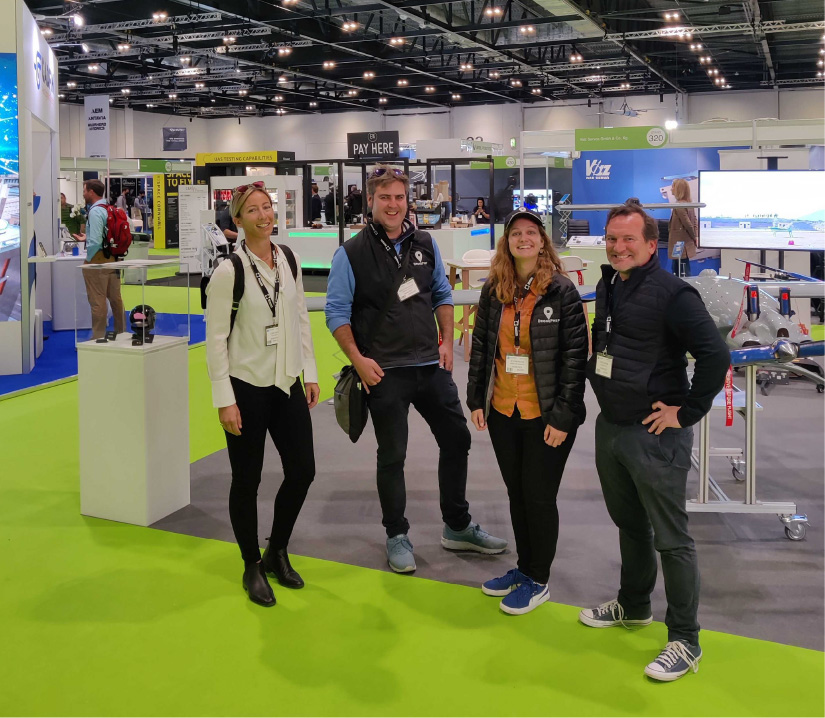
Image by Daniel Arkell

How did you get involved in drone work?

I left a corporate job in 2017 to pursue my passion for photography. That very quickly morphed into video work and then, over three years ago, I decided I wanted to start offering aerial drone filming and photography commercially. I’d been flying recreationally for about a year at that point, and in 2018 I did the PfCO training. Drone work initially started off as a bit of an “add-on” to my video production business at the time, but it’s become one of the offerings I’m best known for.

Sam Gillespie

What kind of drone work do you do now?

There are essentially two types of drone jobs I carry out. The first is acting as a drone operator/supplier on large-scale productions where we will either fly the Inspire 2 (with dedicated camera operator) or carry out the filming with a Mavic-series drone plus spotter/observer. Files are offloaded or sent to the client and that’s where our involvement ends. The second is the full-package, start-to-finish work with clients where we’ll carry out all the pre- and post-production, etc. As for the industries, it’s been everything from construction to property companies and automotive… the beauty of aerial drone filming is its versatility across sectors.

And which area do you enjoy the most?

The automotive stuff is always pretty fun. Challenging, but fun chasing cars/bikes at full speed. And it always looks cool in the showreel!

How much time do you spend flying, versus planning and post-production?

Not enough I don’t think! Of course, living in the UK, a lot of what we do is weather dependant. We had a job back in February that we had to push back three or four times because of the rain, wind and snow on different days.

When I started out, pre-flight planning would take quite a long time, but once you’ve done a few commercial jobs, you know what you’re looking for. One tip I’d give to people starting out: don’t be afraid to pick up the phone. I’ve done jobs at the end of one of Heathrow’s runways. I called up on the Monday and had permission ready to go for the shoot day on Wednesday. These things can often take much longer though, so it’s often a case of managing the client’s expectations of what is possible at short notice.

I’ve been able to secure Operational Safety Case, or “OSC”, permissions for Over The Top Drones which means we can not only operate at reduced distances (on take-off/landing and in-flight) but also at 600ft (subject to various conditions being met as part of those permissions from the CAA). This opens a lot of doors in terms of where we can operate in congested areas, but the pre-production time on these jobs is of course typically much longer due to the increased risk and all the mitigations that need to be put in place.

What advice would you offer pilots starting out?

I’d say work on getting a killer body of work. A lot of people do the training, then they’re wondering why the phone isn’t ringing, but you’ve got to work on building that network. Every time you take a great shot, post in online, show everyone you know. Every time you meet someone, tell them “I’m into drones”, people always find it interesting as it’s still pretty novel. And maybe the people who see your post or hear your stories don’t need a drone operator today, but six months down the line when they do, they’ll remember you and you might get a call or message.

Sam Gillespie

I’d also recommend focusing on shooting the kind of work you want to do. By that I mean, if you’re just shooting roof surveys, it’s going to be hard to do travel photography, because your clients are going to want to see it in your portfolio. When I wanted to break into the construction industry, I approached a small local company and got some great footage of them with heavy-lift cranes which I was able to show as an example to one of the UK’s largest construction companies. I’m sure that’s what got me the job.

How do you think the industry has changed?

I think the barriers to entry are lower now. You can pick up a Mini 2, fly in a city with just an A2CofC. Camera quality is so good nowadays also, for less than £1,000 you can be getting stunning, 4K quality video.

Sam Gillespie

Are you using The DronePrep Map?

I am. I use a few different applications for pre-flight planning, one of which is DronePrep. What’s great with DronePrep is that if you’re really struggling to find somewhere to take off, you can quickly find landowner contact information on the map. I’ve used that in the past to get in touch with landowners near me, it’s a very useful service. Another good feature is just how quickly you can get latitude and longitude positions if you need to run a NOTAM search. And being able to see all the local landmarks that you might want to consider when planning a flight – schools, police stations, that kind of thing.

And looking to the future?

Drones are here to stay and I’m hoping that people’s hesitancy towards them is going to diminish with time. I’m sure the number of people working in the industry is going to skyrocket – not trying to make a pun there! – and I hope there will be a better environment for both recreational and commercial operators.

A lot of operators are going to have to update their fleets when the class marks come in to operate in congested areas or at big events. The rule changes have been a lot for us to get our heads round, and I’m probably in the same camp as a lot of pilots who are still operating under legacy permissions from the old PfCO. So that means at the start of 2023 things are going to change again, and we’re going to need to go down the GVC route.

As for the work itself, you can see people are starting to use drones for all sorts, like 3D-mapping of buildings, or to help inform decisions on renovations. However, I’m firmly on the creative side of things and much prefer shooting moving objects!

Sam Gillespie

Image by Tom Kahler

Follow Sam on Instagram and see more of his work on his website:

https://www.overthetopdrones.co.uk

Zero to 400, Part 4: Tackling the A2 CofC

Zero to 400

Zero to 400 is a record of my journey from casual observer to (hopefully) confident drone pilot. This isn’t a detailed guide to legislation, and I’m certainly no expert on the ever-changing world of drones. I hope these posts can serve as a guide to the novice pilot and answer the basic questions from anyone interested in drones.

Part 1Part 2Part 3Part 4

After getting to grips with the Drone Code, receiving a Flyer ID, and learning about drone qualifications, I finally did a bit of flying.

With the Flyer ID, I can only fly within the A1 and A3 subcategories. We talked about that in the last post – if you missed it, you can read it here.

I’d quite like to fly in the A2 subcategory also. A2 gives me a bit more flexibility: I can fly a larger drone, closer to people and in urban areas. Because we use the DJI Mavic 2 for work flights, in all sorts of locations, I decided to look into it.

The A2 CofC

To fly in the A2 subcategory, I need to get an extra qualification. This is called the A2 Certificate of Competence (or, A2 CofC for short).

There are lots of different course providers for the A2 CofC, but the format is usually the same. There is a short training course, followed by an exam. Most of the courses are online – I’m not sure if this is a Covid thing.

Before completing the exam, you need to have received a Flyer ID and have carried out some practical flying.

Enrolling in a Course

For my A2 CofC, I used Consortiq, who run the training in partnership with Leaping Wing. The course is delivered via a 3-hour online training course, followed by the exam.

Before the course, I was sent joining information and a link to the Leaping Wing online learning portal.

I was asked to work through some of the learning content ahead of the course. This was posted to me in a handy training book.

Being the terrible student that I am, I forgot about the course and waited until the night before to pick up the book.

On the day of the course, we were invited to join via Google Meet. I was surprised to find it was only a small group – two of us were taking the exam, two were course trainers.

Course Content

Three hours can fly by quickly when it’s well-planned. I was pleased with how interactive the course was – it felt like more of a conversation than a lecture. The trainers talked us through each module, discussed the regulation changes and asked us to relate to our own practical experiences. There were lots of questions and discussions throughout.

The modules covered areas such as meteorology, battery types and flight planning. Some of the information was similar to the Flyer ID. Some of it was more technical, like battery load capacities and weather fronts. There were a few topics I wasn’t well-versed in, but nothing too complicated.

A2 CofC

Doing the Exam

At the end of the 3-hour course, we reviewed what we had learned and were given a quick break before the exam. Like the Flyer ID, it’s a multiple-choice test done online. As we were working from home, we were asked to keep mics and cameras on during the test. I guess that’s to check we weren’t trying to cheat!

Although we had over an hour to complete the exam, I think both of us were finished within 30 minutes.

The course prepared us for the exam well and I found just two or three questions where I was second-guessing myself. In the end, I passed with just one question incorrect.

After the exam, I was sent the A2 CofC certificate by email. It looks a bit like the Flyer ID, with a CAA logo and QR code on it.

A2CofC

Final Thoughts

The A2 CofC is a course I believe is worth doing. The content was informative, the format was straightforward and the exam wasn’t too challenging. I’d definitely recommend it to other pilots, especially those like me who don’t have a strong aviation background.

After the course, I spoke to Michael Surcombe, Director of Leaping Wing, who delivered the training.

“The A2 Certificate of Competency is a great option for anyone looking to fly drones, especially if they are starting out with a new business. Before we had the A2, the barriers to entry were needlessly high for people intending to fly lighter drones.

Should drone flyers take the A2 at all? Definitely, at least if they are going to be flying anything bigger than pocket drones. WIthout an A2 qualification, you’re really limited as to where you can fly legally (think ‘big open field’). There’s also a real danger you’re inadvertently going to fly somewhere which is going to get you into trouble. Interestingly, I’ve had people come to me for the A2 certificate who probably didn’t need to from a legal perspective. However, they want to be sure they are flying safely and legally. The A2 CofC is the perfect way to achieve that.

One thing I’m REALLY passionate about is that we make the course as relevant to people’s flying as we can. We follow a core CAA curriculum, with our course partners Consortiq. That means we cover weather, technical knowledge and operating limitations/procedures. But I also cover as much as I can on how to get the best results from your drone. Areas such as camera setup and efficient planning. Quite a few people also ask for a flight training session, just so they don’t have to spend hours on YouTube working things out!

In short, I think the A2 course is revolutionising the drone world. It’s making it easier than ever before for people to equip themselves with the skills to fly safely and build a business!”

– Michael Surcombe, Leaping Wing

You can find out more about drone regulations by clicking here.

We used Consortiq and Leaping Wing for the course. Check out the link below for more information:

https://consortiq.com/a2-cofc-instructor-led-drone-course/

Landowner Permission

Even with a good understanding of the regulations, it’s important to check for bylaws or local restrictions when you fly your drone. Check out The DronePrep Map for everything you need to plan flights safely.

DronePrep Map

Drone Insurance: The Basics

Research

With any big decision – moving house, buying a car, booking a holiday – comes the fuss of scouting providers, calculating liabilities and tweaking premiums. Not to mention the added pain of talking meerkats. Fortunately, when it comes to drones, the process is much easier than you would expect.

Insurance is a legal requirement for some pilots and a great-to-have for others. Today, I’m looking at the rules around drone insurance, what should be included in a policy and why it might be worth having, regardless of the legalities.

Dec 12th 2021: Since this article was first published, Flock have stopped issuing new drone insurance policies.

The legal stuff: Do I need insurance?

Drone legislation is always a heated topic. So, instead of getting lost in legalities, let’s just see what the CAA’s Drone Code has to say.

The Drone Code states the following:

…If you fly a drone or model aircraft that weighs less than 20kg for fun, recreation, sport, or as a hobby, you can choose whether or not to have insurance.


If you fly for any other reason, you must have third party liability insurance…


…If your drone or model aircraft is 20kg or more, you must always have third party insurance, no matter what you use your aircraft for.

Without picking apart the legal definition of fun, we can make some guesses as to what this means for pilots.

For drones that weigh over 20kg, you need insurance. It doesn’t matter what you use the drone for – just get insured.

For drones that weigh under 20kg, you might need insurance. It depends on why you are flying.

So, what’s the verdict?

To keep it really simple: If you are a recreational drone pilot, or hobbyist, you probably don’t need insurance. If you are a commercial pilot, you probably need insurance.

Although the latest drone regulations do little to distinguish between these two groups, insurance appears to be the one area where hobbyists and working pilots are set apart. So if you’re flying for work, you probably need to get insured.

For more information about UK regulations, check out the links at the end of this article.

The non-legal stuff: Should I get insurance?

Legal stuff out the way (phew!) and there are some other pretty good reasons to get insured.

Price

It’s pretty cheap. We’re talking 10s, not 100s, for most hobbyists and small-time commercial users. I’ve personally bought hourly policies at just over £1 per hour. We also found a rolling policy for around £20 per month. When the drone is worth hundreds (or more), it seems like a no-brainer to invest in a safety net.

Money

Coverage

The policies themselves cover a lot. My experience with car insurance in the past has been a miserable one. Sky-high premiums and thousands of optional extras that don’t amount to much when it comes to claim time. Drone insurance is a lot more straightforward. It covers most types of damage and usually offers hassle-free payouts. That’s as long as the pilot has been flying safely and legally.

Cover

Local restrictions

There are a number of sites, clubs and events where insurance is a requirement for entry. Those of you familiar with the world of model aircraft will know that BMFA insurance is required at many flying fields. A similar scheme exists with FPV UK for model aircraft and drones. We’re seeing these rules popping up more and more, so consider the added benefit of insurance opening new locations.

Local restrictions

Drone insurance: What are my options?

Wait, what exactly is drone insurance?

I’ll caveat this part by saying I’m not an insurance expert. My limited experience of insurance is drawn from purchases of car, contents and travel insurance policies. A bit of research helped me put the pieces together with this next part.

Drone insurance usually consists of two distinct parts – “liability” and “equipment”.

Liability

Liability

Public liability or third party liability insurance covers damage and legal fees for property damage, or bodily injury, to a third party. So, if you crash into your neighbour’s fence, or hit a pedestrian – please try not to do this – and cause damage, this is the insurance that you would be claiming from. Liability insurance is designed to offer protection against third-party claims. It pays for the legal fees and repairs, but it won’t necessarily cover damage to your own kit.

Equipment

Equipment

Equipment cover is for the drone itself, or any associated equipment. So, if your drone is damaged in a fall, or the camera lens cracks, or if the return to home malfunctions and your precious drone ends up diving propeller-first into a lake, this is how you would cover the cost of repair – or replacement.

Drone insurance policies may include one or both of the above. There are also extra benefits like international cover, cover for theft, or replacement drones while yours is being fixed. Each provider offers different terms and conditions, so check the rules carefully before you buy.

Who can I buy drone insurance from?

Some of the big household names in insurance do offer drone policies. However, I think the best option is to choose a specialist drone insurance provider. They know the industry, they understand the kit and many of them fly in their spare time.

Check out the insurance page on our website by clicking here for more information on the popular specialists – Coverdrone and Moonrock

The future of drone insurance

With drone use increasing and technology becoming more advanced, I was keen to find out how the industry is changing. I also wanted to ask: “How might things look in the future?”.

I spoke to each of the three specialist insurers linked above. I asked about their experiences in a rapidly changing industry. And I tried to understand current trends in drone insurance. Here are some of their thoughts:

Coverdrone

Coverdrone

“We have been perfecting the Coverdrone product over the past 14 years, during that time we have always put customer service at the forefront of everything we do. Our product is essentially our claims service, and we are very proud to say we have settled 99.25% of claims reported.

BVLOS is a big up-and-coming area, as is drone shows and drone swarms, especially in Europe. Our policies always react to the changes in the drone market, and we can now provide that cover.”

– Daniel Dodd, Coverdrone

Flock

Flock

“When Flock started in 2016, it was mainly film and photography, with a bit of surveying. Now, we’re seeing everything from crop spraying in Ethiopia, to flying cars and monitoring sulphur emissions in shipping lanes.

We provide insurance to a company called Lorenz Technology in Denmark, which from our understanding, is the first case where an AI (Artificial Intelligence) is listed as a pilot on an insurance policy. There’s a lot of other companies using AIs for assisted flight, this is just the next level of that.”

– Sam Golden, Flock

Moonrock

Moonrock

“Moonrock insure pilots and organisations ranging from the independent operator all the way through to BVLOS operations, such as the recent NHS trials and large drone displays with over 300 drone in the air at any one time.

We are now starting to see a large shift towards in-house operations, whereby businesses are starting to bring pilots in house. This allows organisations to train pilots specifically in the needs and requirements of the organisation.

We have also launched a hobby drone insurance policy, as up until now its been nearly impossible for the general public to obtain cover for public liability and damage to the drone.”

– Simon Ritterband, Managing Director, Moonrock Drone Insurance

Where can I learn more?

Check out the links below:

CAA Drone Code
https://register-drones.caa.co.uk/drone-code

CAA – Aircraft Insurance
https://www.caa.co.uk/Commercial-industry/Aircraft/Operations/Insurance/Aircraft-insurance/

CAP722 – Unmanned Aircraft System Operations in UK Airspace – Guidance
https://publicapps.caa.co.uk/docs/33/CAP722%20Edition8(p).pdf

REGULATION (EC) No 785/2004 OF THE EUROPEAN PARLIAMENT AND OF THE COUNCIL of 21 April 2004 on insurance requirements for air carriers and aircraft operators
https://eur-lex.europa.eu/legal-content/EN/TXT/?uri=celex:32004R0785


Landowner Permission

Even with insurance, it’s important to check for bylaws or local restrictions when you fly your drone. Check out The DronePrep Map for everything you need to plan flights safely.

DronePrep Map

DronePrep attends DroneX Trade Show

After the lockdowns and limitations of the last two years, the DronePrep team was excited to finally see industry friends – in person! – at the DroneX Trade Show and Conference. The show was held last week at the ExCel centre in London.

DronePrep’s Gareth Whatmore joined Aerospace Cornwall on their DroneX stand. They shared with visitors the successes of the Future Flight Phase II drone delivery project in the Isles of Scilly. The project was a major step forward for UK drone delivery and a great example of the region’s investment in technology.

The two-day show also saw DronePrep Co-founder and CTO Claire Owen join the judging panel for the DroneX Innovation Awards. Claire visited a number of innovative DroneX exhibitors. After a 3-minute pitch from each candidate, and a long deliberation, they crowned Airial Robotics the winner for their Gyrotrak.

The DroneX Trade Show was an excellent opportunity to find out about companies from all areas of drone use. Exhibitors included everyone from drone manufacturers to software providers to end-users looking to deploy drones in their operations.

The team were thrilled to attend one of the most important events on the calendar for anyone in the drone industry. We enjoyed the opportunity for the whole team to come together in person.

“It was great to finally meet the amazing people who I’ve had the pleasure of zoom-ing and emailing these last few months! I joined DronePrep before the UK lockdown was over, so it’s the first opportunity I’ve had to see people face to face. We were thrilled to see the industry come together and exhibit all the latest innovations in UAVs.


– Beth Mason, Marketing Manager, DronePrep

To learn more about the DroneX trade show, check out the website below:

https://www.dronexpo.co.uk/ 

DronePrep Innovation

The DronePrep Innovation team is championing drone technology in the UK. Working with industry leaders, we are pioneering drone solutions to complex problems. Find out more by clicking here.

Droneprep Logo BW

Zero to 400, Part 3: Understanding Drone Qualifications

Zero to 400

Zero to 400 is a record of my journey from casual observer to (hopefully) confident drone pilot. This isn’t a detailed guide to legislation, and I’m certainly no expert on the ever-changing world of drones. I hope these posts can serve as a guide to the novice pilot and answer the basic questions from anyone interested in drones.

Part 1Part 2Part 3Part 4

So I’ve read the Drone Code, got my Flyer ID. What’s next?

I would love to dive into a post about getting the hang of controls, or taking great pictures, but before we start that, I’d like to talk about the other qualifications available to both hobbyists and commercial pilots.

Before we look at the certificates themselves, let’s understand why we might need them.

Flight Categories

The CAA (Civil Aviation Authority), who regulate drone use in the UK, have decided to distinguish between different types of drone flight by splitting them into three different categories of flight. These are based on the level of risk in the flight, so they consider factors like proximity to other people, weight of your drone, etc.

These three categories are called Open, Specific and Certified.

The Open Category is for low-risk flights and does not require any special approval from the CAA.

The Specific Category is for higher risk flights and requires operational authorisation from the CAA.

The Certified Category is for even higher risk flights, with larger aircraft and a similar level of regulation and authorisation to manned flights.

I’m going to wager that the majority of drone flights carried out in the UK fall under the Open Category. The Open Category is divided into three different subcategories – A1, A2 and A3. I’ll try to keep this brief:

A1 – “Fly over people” – very lightweight drones, very low risk.

A2 – “Fly close to people” – lightweight drones, a little more risk.

A3 – “Fly far from people” – heavier drones, but further away.

You can fly most drones in the A1 and A3 categories without the need for extra training – you just need to get your Flyer ID and read your drone’s user manual. The logic here being that A1 is only for very small or toy drones, and A3 is away from the risky spots. There’s a great table here from the CAA that breaks down the different drones and types of flight.

CAA Open Category

Jump to the last column and you’ll see that for anything in the A2 category, and for one class of drone in the A1 category, you will also need something called an A2 CofC Theoretical Test.


The A2 CofC 

The A2 CofC (Certificate of Competency) is a training course and qualification. It consists of four modules and covers the basics of meteorology, the principles of flight and best practice for safety and risk management. Both the course and theory exam can be completed online, with the qualification lasting for 5 years before renewal.

The A2 CofC is popular for pilots who are flying small drones in relatively low-risk areas. It’s quick and cheap to complete – the test takes 75 minutes, costs less than £100 and you can find cheap training courses online. Or you could just self-study and take the exam straight away. Once completed, you are pretty much covered for flying in the Open Category.

If you want to move on to the Specific category, you’re going to need a bit more training.


The GVC

In order to get “operational authorisation” (permission from the CAA) for Specific category flights, you need to have completed another certificate called the GVC.

The GVC (General Visual Line of Site Certificate) is the next level up in drone qualifications. There’s a theory exam and practical test, plus the requirement to create an operations manual and follow the procedures.

The GVC is aimed at commercial pilots flying heavier drones in more high-risk or complex environments. It’s slightly more expensive and time-consuming, but it’s a must-have for pilots looking to fly outside of the limits of the Open category.

Important! This is all really, really new

Something I quickly realised when I started reading about drones is that the UK legislation all changed fairly drastically on 31st December 2020. So from 1st January 2021, there were big changes to the rules and the whole industry is still in a transitional phase as these changes are put into practice. The drone classes (C0, C1, etc.) in the table above aren’t even being used properly yet, as far as I’m aware the manufacturers haven’t yet produced any drones with these marks.

Prior to regulation D-day, something called the PfCO (Permission for Commercial Operation) was the go-to training option for pilots. The CAA used to separate recreational and commercial work in its regulations. Commercial pilots were required to have completed the PfCO in order to fly for work. The CAA no longer distinguishes between recreational and commercial flying when considering pilot training, so in theory you could fly commercially with some drones in the Open Category using just a Flyer ID. One area where there is still a distinction is in insurance – pilots flying commercially must have third party liability insurance for their flights.

If you completed a PfCO before the changes, it will still be valid – so long as you don’t let it lapse. For any new pilots, following the Flyer ID the big options for further training are now the A2 CofC and the GVC.

What else do I need to know?

There’s a lot more to learn about UK drone legislation and how the categories work.

Click here for the CAA’s guide to flying in the Open Category.

Landowner Permission

Even with a good understanding of the regulations, it’s important to check for bylaws or local restrictions when you fly your drone. Check out The DronePrep Map for everything you need to plan flights safely.

DronePrep Map

What’s on the DronePrep Map?

It’s holiday season, so with many of our friends and colleagues away, we decided to skip Spotlight On for this month and instead talk datasets with Claire Owen, co-founder of DronePrep. With a background in property and land data, Claire has a wealth of experience in data aggregation, and her passion for software has been the driving force behind the DronePrep Map.

What can I see on the map?

The map has a number of different layers with so much you can use to plans drone flights. There’s data from HM Land Registry, Ordnance Survey, Esri, what3words, NATS, and custom DronePrep data layers too… There are a few standard things that you see on most drone maps – FRZs etc – but the exciting stuff for us is the land ownership data, local authorities, bylaws, and the ability to plan future flights with the drawing tools.

DronePrep Map Land Ownership

and How did you choose what to include?

Gareth really did a lot of the groundwork on this: he was trying to map out the canal network by drone, and he couldn’t find landowner information to ask for permission to take off and land. This frustration is what triggered the idea behind the DronePrep Map many years ago.

We spent a lot of time thinking about what data to use and talking to drone pilots, as we wanted to design a platform that would be helpful for all our users. I have a very strong rule – always ask yourself “Why?” – if there’s a dataset you want to include, there’d better be a good reason for it.

Map Desktop VersionWho builds the software?

We have an external development team, Borwell, who are actually our neighbours here at Malvern Hills Science park, and they are brilliant. We work regularly with one awesome developer, Bob, and there’s a much wider team who join for the big updates. They have a number of experts in cyber security, so we know everything we’re doing is safe and secure.

How does the DronePrep Map differ from its competitors?

There are a few great drone maps out there, but we haven’t seen any with the variety of data that we offer. Especially the landowner stuff – we spent a lot of time pulling in data with the names, addresses, title numbers and such. It costs us a lot and there’s a huge amount of work behind the scenes to make it usable. Also, there’s cool features like the daylight tool, which shows where sunlight falls on the map at any given date in the year – that’s really useful, especially for photographers and videographers.

Map Drawing Tool
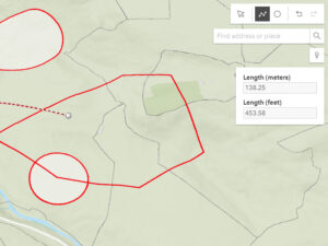
What am I getting with the paid version?

You’re getting all of the landowner data – title number, owner name, contact details. If you’re planning to fly in a new spot but you don’t know who owns the land, this is gold. You also get the ability to draw, measure and save flight plans on your account. The measurements are great for helping you comply with the Drone Code, as you can check distances from built up areas and other potential hazards.

Why do you have to charge?

We don’t charge our users for the stuff we get for free, but some of the best data we have is paid for. We decided early on to prioritise accuracy over cost and we chose trusted, paid for options over unvalidated free versions, so we know the data we have from HM Land Registry and Ordnance Survey is consistent, definitive and authoritative, ie. – it’s correct.

Don’t forget the Microsoft cloud infrastructure: and we’ve got over 100 million rows in our database. There’s a lot of data, it’s a lot of storage, a lot of processing!

I think more importantly to note: we don’t have any advertisements and we don’t sell user data. We only ask for an email address and password. The only way we use this data is to allow users to access the platform, and to add emails to our mailing list. The data doesn’t go anywhere else.

Map Daylight Tool
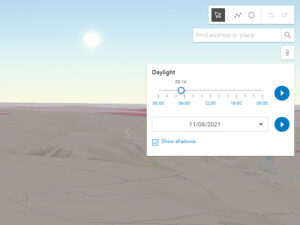
I don’t fly every day – should I upgrade to a paid subscription?

We’ve built the subscription model to be really flexible, so you can upgrade or downgrade at any time. If you’re not flying all year round, there’s nothing to stop you upgrading to plan some flights, get landowner permission, try out all the tools, then downgrade until you need it again.

What’s up next?

We’re about to do a huge update to the landowner portal to make it more intuitive for landowners to add policy information, so expect to see a lot more land opening up for drone use. We’ll also be doing some user feedback sessions again, hearing from the community what’s useful and what’s not. And next year we’ll be launching a mobile application for the map.

Did you say, “Mobile app next year”?

At some point next year, definitely, yes. Just don’t ask me which quarter yet!

Register on the Map

It’s free to register on The DronePrep Map – we just need an email address. Start planning your flights today:

The DronePrep Map

DronePrep Map