-
Royal Mail has partnered with DronePrep, Skyports and what3words to become the first nationwide UK parcel carrier to deliver a parcel for recipients via an unmanned aerial vehicle.
-
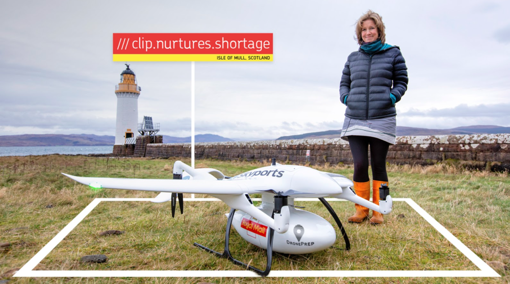
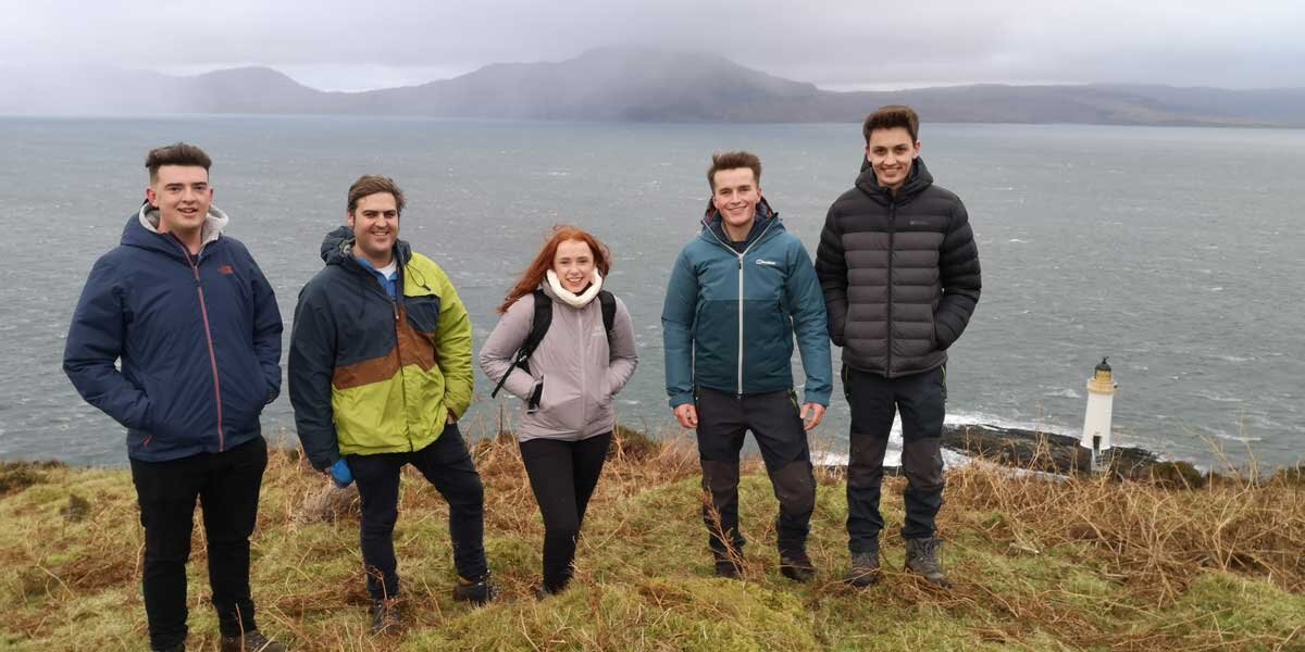
The first delivery took place to a remote lighthouse on the Isle of Mull.
-
Next year the consortium will undertake a consultation with islanders on the use of drones to deliver to rural communities on the Isle of Mull – the second-largest island of the Inner Hebrides.
-
This will help to identify opportunities to support postmen and postwomen in delivering to very remote areas and addresses in the UK.
Royal Mail has joined forces with a consortium of established UK drone companies – including DronePrep and Skyports – and addressing technology what3words, to become the first UK parcel carrier to transport a parcel for recipients via an unmanned aerial vehicle (UAV). In a UK first, the consortium arranged an initial drone delivery to a remote lighthouse* on the Isle of Mull this month.
 This is the first step in a groundbreaking consultation programme and trial in the New Year, which will focus on engaging with the community to explore the viability of using drones to deliver to rural communities on the Isle of Mull, where Skyports is already using its drones to help NHS Scotland with the response to COVID-19. This will help to identify opportunities to support postmen and postwomen in delivering to very remote areas and addresses in the UK.
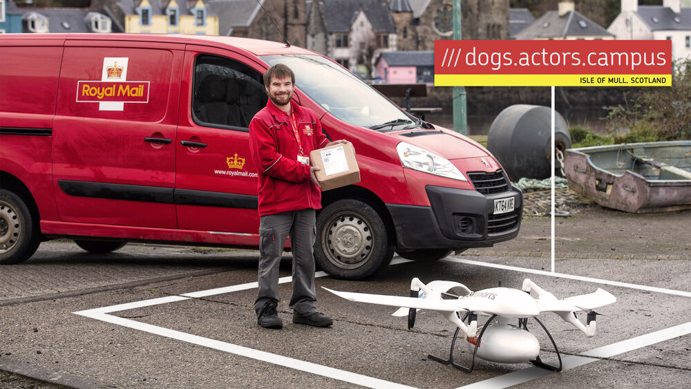
As with all Royal Mail deliveries across the UK, the postcode will route the parcel towards its destination. The local postie will then use drone delivery to reach the most remote locations in their patch faster. For the drone delivery, residents consulted on the Isle of Mull will be invited to use the DronePrep platform to assess the viability of their property for drone delivery and pinpoint a suitable landing location within their ownership using the what3words integration.
To enable this for the trial, Royal Mail is asking recipients to provide the what3words address, a 3 metre by 3 metre square, that corresponds to the precise landing point for delivery of Royal Mail parcels via the drone from the Royal Mail van.
 Tom Nunn, local postman for Isle of Mull, said: “I am very pleased to be involved in this fantastic trial. It is an exciting opportunity to test out new ways of working to support us posties that deliver in some of the most remote areas of the UK. Some of the houses on the Isle of Mull include a thirty-minute walk to the front door so the use of drones will be a huge help!”
Nick Landon, Chief Commercial Officer at Royal Mail, said: “Delivering the first live parcel in the UK by an unmanned drone was a landmark day for us. We are incredibly proud to be working with DronePrep, Skyports and what3words to trial new ways to support the more remote and isolated communities we serve. This is part of our constant drive to incorporate the best innovative technologies into our network. We’ve seen a huge increase in parcel volumes this year and this is just one of the ways we are looking at to support our frontline delivery staff and deliver fast, convenient and green services for all of our customers.”
 Gareth Whatmore, CEO of DronePrep & Consortia Lead, said: “In the last couple of years, drone technology has matured and with it the industry’s ability to solve real world challenges. Our collaboration with our superb partners Royal Mail, Skyports, what3words and the residents of the Isle of Mull is a huge opportunity for us all to learn more about how drones can complement and supplement existing Royal Mail delivery services. We are both delighted and proud to lead on this innovative collaborative project and for the DronePrep platform to help in determining future UAV flight and delivery opportunity for Royal Mail and the local community.”
 Chris Sheldrick, co-founder of what3words added: “By labelling every 3m square in the UK with three words – a what3words address – recipients are very easily able to communicate their desired drone delivery location. Our technology perfectly complements traditional addresses, but by adding a layer of accuracy when needed. 2020 has demonstrated the need for fast, reliable deliveries and what3words is a perfect tool to assist Royal Mail on their mission to continue to innovate.”
 Duncan Walker, Chief Executive of Skyports, said: “We are delighted to contribute our experience of flying delivery drones for the NHS around the Isle of Mull to this exciting project. Delivery drones are already proven as a fast and reliable solution for transporting packages to poorly connected rural communities. This trial with Royal Mail, what3words and DronePrep has the potential to lay the foundations for a future service to complement the one provided by Royal Mail’s hard-working posties that we rely on today.”
In early 2021 we will embark on a groundbreaking consultation programme and trial, which will focus on engaging with the community to explore the viability of using drones to deliver to rural communities on the Isle of Mull.


 This is the first step in a groundbreaking consultation programme and trial in the New Year, which will focus on engaging with the community to explore the viability of using drones to deliver to rural communities on the Isle of Mull, where Skyports is already using its drones to help NHS Scotland with the response to COVID-19. This will help to identify opportunities to support postmen and postwomen in delivering to very remote areas and addresses in the UK.
 Tom Nunn, local postman for Isle of Mull, said: “I am very pleased to be involved in this fantastic trial. It is an exciting opportunity to test out new ways of working to support us posties that deliver in some of the most remote areas of the UK. Some of the houses on the Isle of Mull include a thirty-minute walk to the front door so the use of drones will be a huge help!”
 Gareth Whatmore, CEO of DronePrep & Consortia Lead, said: “In the last couple of years, drone technology has matured and with it the industry’s ability to solve real world challenges. Our collaboration with our superb partners Royal Mail, Skyports, what3words and the residents of the Isle of Mull is a huge opportunity for us all to learn more about how drones can complement and supplement existing Royal Mail delivery services. We are both delighted and proud to lead on this innovative collaborative project and for the DronePrep platform to help in determining future UAV flight and delivery opportunity for Royal Mail and the local community.”
 Chris Sheldrick, co-founder of what3words added: “By labelling every 3m square in the UK with three words – a what3words address – recipients are very easily able to communicate their desired drone delivery location. Our technology perfectly complements traditional addresses, but by adding a layer of accuracy when needed. 2020 has demonstrated the need for fast, reliable deliveries and what3words is a perfect tool to assist Royal Mail on their mission to continue to innovate.”