See who owns what land
Search the map to find landowner info for 31 million land parcels
Find a take-off and landing site
Plan your flights from streets, fields, mountains, parks or flying fields.
Everything in one place
Find useful air and land information, fast.
View local drone policies
Access conditions, bylaws and places you can and can’t take-off.
Why use the map?
Flying rules in the UK can be hard to follow. The Drone Code is a great guide for new pilots, but it’s tough to find all the info you need to follow it.
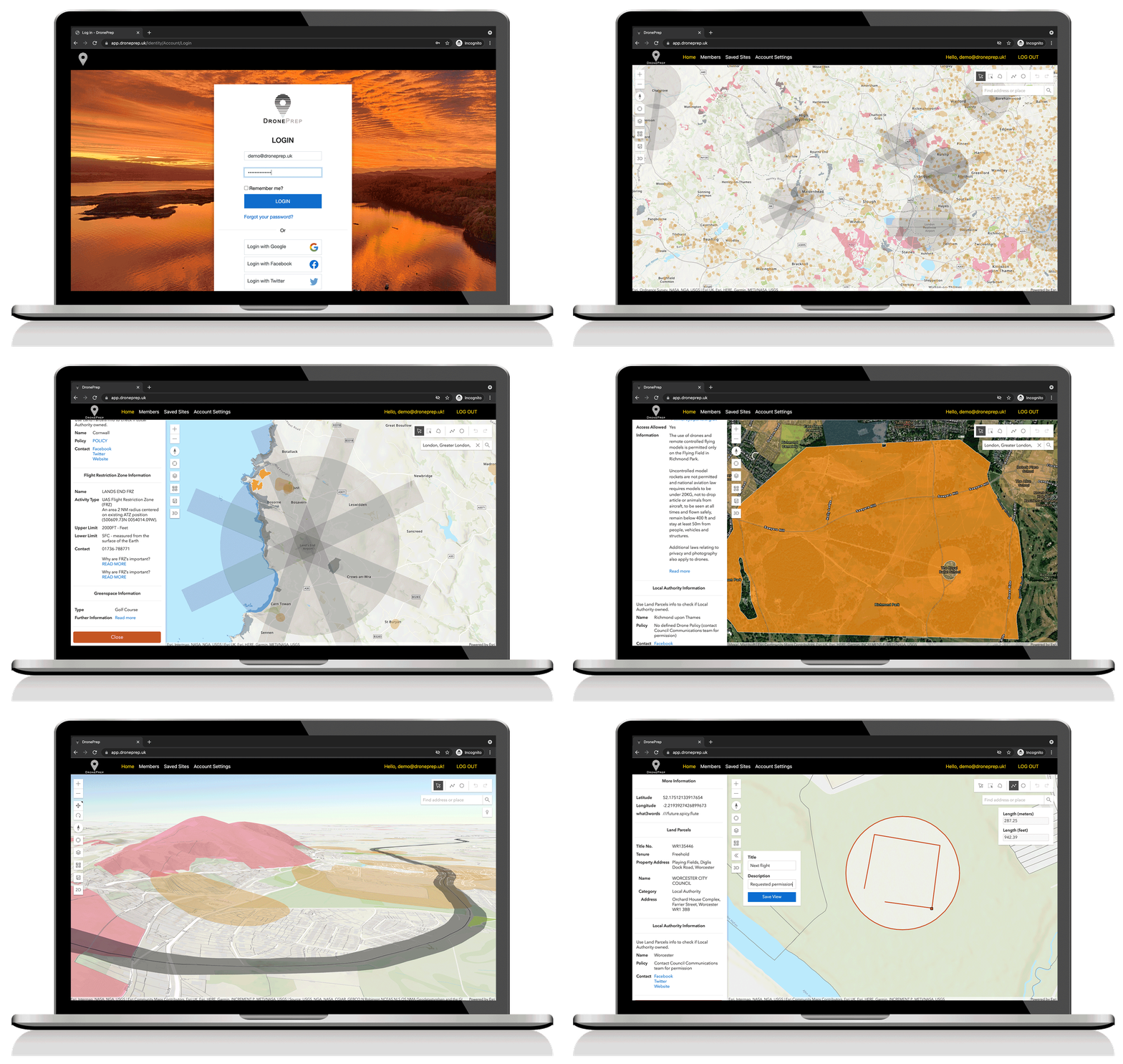
The DronePrep Map shows the key air and land data when planning a flight: airfields, railways, important buildings, foreshore, green space and more.
We also let landowners register their private land and tell pilots where they can take off and land.

What’s on the map?
The DronePrep Map has layers – you can turn them on and off as you please.
There’s a sidebar with information about every piece of land and its owner.
Check the how-to page for more on each feature.

Is it free?
Yes! Registering and using the map is free.
But you’ll get more data with a paid membership.
It’s a subscription, so you can cancel at anytime.
What’s next?
How-to guide
Check out this simple guide on how to use map – there’s a video too!
Guide to layers
Learn more about the data we have on the map and where it comes from.
The Drone Code
Refresh your knowledge of the UK’s Drone laws with our quick walkthrough.
Membership
Love the map? Want some extra cool features? Check out membership options.
Ready to fly?
